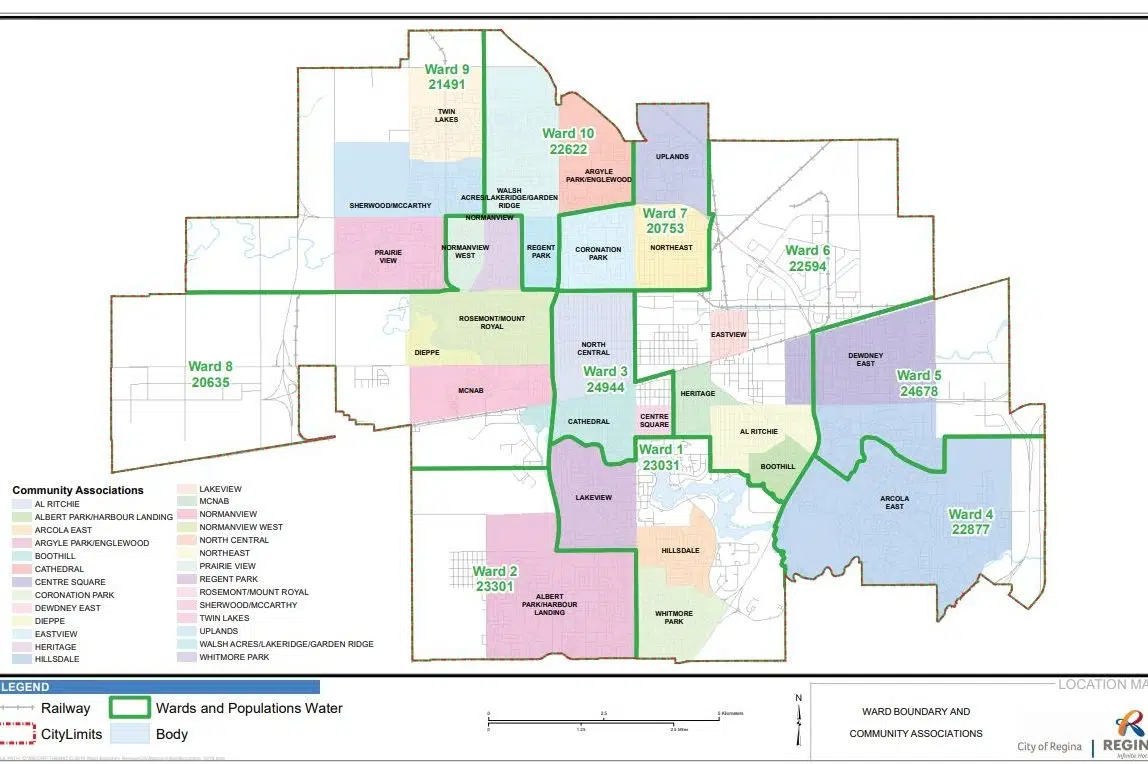
The City of Regina will have new ward boundaries for the 2020 municipal election.
The Municipal Wards Commission is to present its review of the city’s wards to council on Monday.
The report can be found here. Maps showing the current and new boundaries appear below.
The results of the review also can be seen in person at City Hall starting Tuesday at 8 a.m. The maps also can be viewed in the lobby at City Hall until July 5.
The current wards were set in 2014 and were used in the 2016 municipal election. The city is required by legislation to review its ward boundaries after every three elections or when the populations of its wards are unbalanced.
The Cities Act requires that the Municipal Wards Commission divide the city’s population by the number of wards in the city — 10 in this case — to find an average population. The population of each ward then can’t vary by more than 10 per cent from that average.
According to the report, wards 2 and 4 no longer meet that requirement due to population increases in the Harbour Landing and Arcola East areas.
While preparing its report, the commission sought feedback from residents, relied on population statistics from eHealth Saskatchewan, and pondered natural geographic boundaries, the simplification of boundaries, the alignments of community association boundaries, and future growth projections for each ward.
According to the report, after examining all of its criteria, the commission determined that the boundaries for every ward except Ward 9 had to be changed.
The proposed changes were unveiled in March at open houses, which attracted 29 people.
Anyone with questions about the report can contact the Office of the City Clerk by phone at 306-777-7262 or by email (wardboundary@regina.ca).


