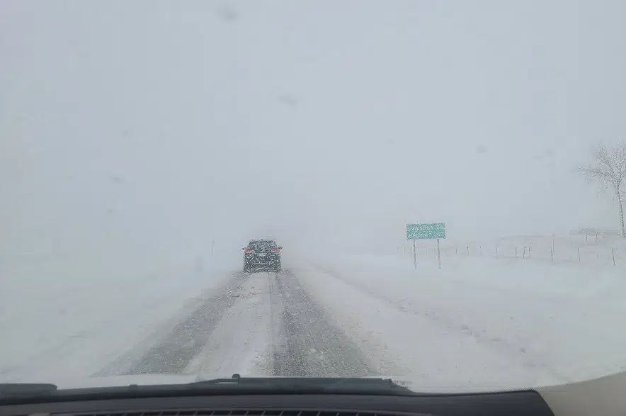
It was only a matter of time before parts of Saskatchewan heard this: The first major snow event of the year is here.
“It happens to be one of those infamous Colorado Lows that is going to be impacting all of southern Saskatchewan (Sunday night) and tapering off (Monday),” Environment Canada’s Brad Vrolijk said.
He said Regina saw about five centimetres — about two inches — fall throughout the morning before the system headed west.
“Inside the city, there has been a little more melting. On the highways, it looks a little deeper,” Vrolijk said.
The snow did lead to highway closures throughout the day, with areas around Moose Jaw being shut down.
Lorna Evans was driving on the Trans-Canada Highway between Swift Current and Regina.
“It’s exceptionally bad between Morse and Chaplin. We shouldn’t be out here,” Evans said. “We’re down to one lane, going about 30 kilometres (per hour) and a car a couple ahead of me slid and went sideways and blocked the highway.
“Several people got out of their cars and pushed and got that car straightened out and now we’re going again.”
Evans said drivers couldn’t see the highway — they were just driving in ruts — and there were near whiteout conditions at times.
The weather also is probably the culprit when it comes to power outages around Moose Jaw.
The SaskPower outage map indicates a number of unplanned outages in the area.
“Our crews are investigating the cause of the outages but it’s likely that most of the outages right now are a result of the weather,” said SaskPower’s Joel Cherry.
“Heavy, wet snow can really wreak some havoc on our system, both by building up on the lines themselves and weighing them down — especially when it’s combined with high winds — but then also by weighing down trees so there are still some leaves on some of the trees and when you get the heavy wet snow building up on there, it can cause the trees to break or sag onto power lines which can cause outages as well.”
Cherry said the weather can also affect how quickly crews are able to respond to outages.
“If roads are in poor shape or closed, it can take longer for us to get out there and find the issue and do the repairs,” Cherry said. “We also have to be sure our crews can do it safely.”
Vrolijk said the system is expected to head east, with another five to 10 centimetres to fall Sunday night and Monday morning in Regina.
“East of (Regina), it’s going to be a challenging night for the area. As (the system) approaches the Manitoba border, it’s going to meet a wall of warm air that’s sort of trapped there,” Vrolijk said.
“We will probably get a transition area where we see rain — maybe along the Manitoba border — switching to freezing rain switching to snow.
“Area like the Moosomin area, northwards towards Yorkton, they may see some accumulating freezing rain overnight that transitions to snow closer to Monday morning. It will be very sensitive to what the surface temperatures are.”
Vrolijk said the winds are bringing cooler air to Saskatchewan.
“You’ll definitely see a couple cold days ahead with highs probably below zero,” Vrolijk said. “It does look like later in the week, there is the potential for a warmup. It looks like some Pacific air is going to be able to push back into the prairies.
“There will be some questions with how quickly that snow is able to melt, but by the end of the week we could see daytime highs back up to the 5 to 10 (Celsius) range.”


