Late spring snowfalls keep changing the outlook for spring runoff across the province.
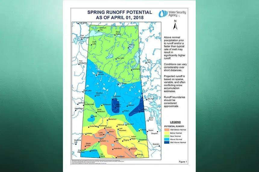
The Water Security Agency spring runoff map for April shows a big split between northern and southern Saskatchewan.
While the snowstorm in March should slightly improve soil moisture, most areas of southern Saskatchewan are still looking pretty dry.
The WSA map shows a band stretching from Maple Creek to Swift Current, Assiniboia, Coronach and Weyburn can expect well below normal runoff.
In areas forecasting low runoff levels, agricultural water supply shortages that began to emerge in the late summer of 2017 may get worse.
There is one pocket in the southwest corner of the province around Eastend and Val Marie that shows above normal runoff conditions.
It is a very different situation in the central and northern regions of the province which can expect to see above normal runoff. Areas around Prince Albert and Waskesiu could see well above normal runoff with some localized flooding.
The cold snap in April is delaying the big melt which could potentially lead to minor localized flooding if the snow melts all at once in some areas.


