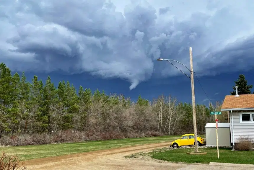
The southeast part of the province can’t seem to catch a break when it comes to storms this season.
Instead of the blizzards that have plagued that area over the past several weeks, severe thunderstorm watches and warnings are in effect for much of the southeast corner of Saskatchewan.
Eric Dykes, a meteorologist with Environment Canada, said the storms will be mostly troublesome throughout Saturday afternoon.
“Some of the storms that will develop … do have the chance of becoming severe,” Dykes said.
Earlier showers left plenty of moisture and energy in the air, giving opportunities to redevelop into showers and more later in the afternoon. It’s a result of a low-pressure system coming up from Montana.
Dykes explained the main concerns for the storm include really strong wind gusts, brief but heavy rain downpours, and hail possibly around the size of a nickel or s’more.
He predicted a “non-zero” but still “very slight” chance of a tornado that would develop right at the beginning of the storm.
Just before 2 p.m. — when Dykes predicted the storm might start — a funnel cloud was seen in the sky near Indian Head.
The cloud only reached about a third of the way to the ground. Already, the storm has begun to move towards the Manitoba border, Dykes shared.
Stormy weather could continue through the afternoon in the southeast and push more into western Manitoba around dinnertime, as late as 7 p.m.
“It’s unfair,” Dykes said with a chuckle, “because I know that western Saskatchewan desperately needs rain. It’s very dry out there.”


