

Listen to daily commentary from provincial news director Sarah Mills
Sarah Mills shares her thoughts on the all-female star-studded space tourism trip that Amazon's Jeff Bezos put together ...
The mild January weather streak in Saskatchewan is ending with a blast.
Environment and Climate Change Canada (ECCC) issued a number of blowing snow advisories on Friday for much of the south-central part of the province, stretching from the Alberta border to the Manitoba border.
Read more:
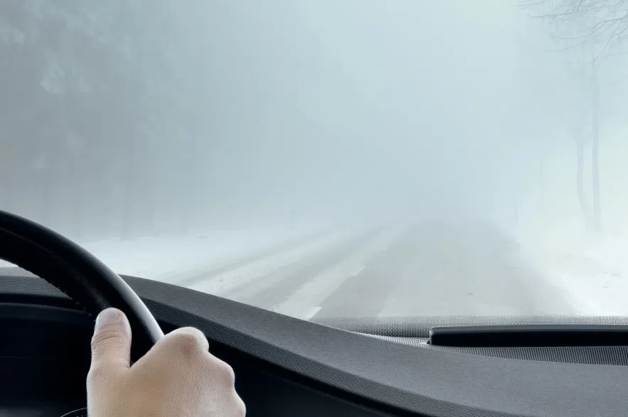
On Friday afternoon travel was not recommended around Milestone, Lumsden and Rosetown because of poor visibility.
Saskatchewan RCMP said in a news release around 5:30 p.m. that the weather was also affecting road conditions in Regina and surrounding area.
Motorists can access information on road conditions and track which roads have been plowed, salted, and/or sanded within the last two hours on the Highway Hotline.
A Highway Hotline around 7:30 p.m. said a number of roads had been closed because of zero visibility conditions including Highway 1 from Moose Jaw to Regina, Highway 1 from Belle Plaine to Moose Jaw, Highway 11 from Regina to Lumsden, and Highway 6 from Regina to Piapot Grid.
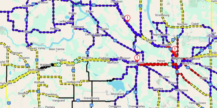
Roads where travel is not recommended are marked in blue, while road closures are marked in red on this Highway Hotline map from 7:30 p.m. (Highway Hotline)
Read more:
Regina, Saskatoon Lloydminster, North Battleford, Kindersley, Swift Current, Wynyard, Assinaboia, Fort Qu’Appelle, Coronach, Estevan, Weyburn and Moosomin were all included in the advisories.
Brad Vrolijk, lead forecaster with ECCC, said on Friday morning the snow is expected to start accumulating by midday in west-central Saskatchewan and will spread southward.
Winds are also expected to pick up to 40 km/h, Vrolijk said, gusting to 60 km/h.
“We’re not expecting full-fledged blizzard-type conditions or anything like that, but definitely if you are traveling through the area today, you will be dealing with probably some areas of pretty poor visibility and blowing snow,” said Vrolijk.
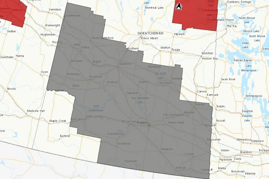
Much of central and southern Saskatchewan was under a blowing snow advisory on Friday. (Environment and Climate Change Canada)
In towns and cities, he said conditions shouldn’t be too bad.
“But as soon as you get out into more open areas or in the rural areas on highways, we could probably expect to see pretty poor visibilities at times with the blowing snow,” Vrolijk noted.
Earlier this week, the Saskatchewan RCMP urged drivers to use extra caution in low-visibility or icy conditions, noting that Mounties have responded to eight fatal crashes which claimed 11 lives between Jan. 1 and Wednesday.
The Mounties encouraged all drivers to slow down on icy or snow-covered roads, and to always check road conditions using Saskatchewan’s Highway Hotline before heading out.
“Please remember the basics, drive to road conditions, obey speed limits, never drive while distracted or impaired by alcohol or drugs and always wear your seatbelt, because choosing to wear one can make the difference between life and death in a collision,” RCMP superintendent Grant St. Germaine, who leads Saskatchewan RCMP Traffic Services, said in a statement.
In Regina, around two to four centimetres of snow is expected to fall on Friday, with another five to 10 centimetres expected on Friday night.
In Saskatoon, five to 10 centimetres of snow is expected to fall Friday night, with another two to four centimetres coming on Saturday.
“Enough that you’ll probably have to shovel by the time it tapers off. But it’s not going to be piling up at a huge rate or anything like that,” said Vrolijk.
Along with the snow, Vrolijk said temperatures are also expected to drop.
He says the change comes as “really cold Arctic air” has been lurking in the northern prairies and creeping south over the past week.
“As this moves through the second half of the weekend and into next week, we’ll definitely see across the entire area a brief cold snap, with temperatures back down in the -15 C to -20 C range for highs, and overnight lows could probably get down close to -30 C again.”
Vrolijk said another warm spell doesn’t seem likely at this point.
“There might be a system that grazes by the region the middle of next week, which could bring temperatures back up towards more seasonal values,” he said.
“But then it looks to cool off again to the latter half of next week.”
The latest updates on the weather alerts can be found on Environment Canada’s website.
Read more: